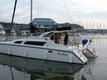
S/V Freedom Sails!!! October 15, 2006 1:01 P.M.
Pre-Log
After two days of friends traveling from around the United States to see us off, we departed Green Turtle Bay on October 15th. The pre-sail parties and activities were a blast. Thanks to Tom Howard and lovely Diane for inviting our large group to the Yacht Club for dinner. Steve and Linda Bennett, Marty and Ellen Roberts, and Tim & Miriam Trycha went for a day sail, then Aunt Sandy and Cousin Julie joined us. We appreciated all of the "consumables" they brought for us. It was truly a great send off. - Jim and Deb
.jpg)
.jpg)
.jpg)
.jpg)
.jpg)
.jpg)
.jpg)
.jpg)
October 15th - We departed Green Turtle Bay twice today. First was early and it was a simulation. I felt like Bill Clinton. The second time was after we cleaned out the dock box, removed and cleaned all of the dock lines, washed the boat with the last of abundant water, filled the water tanks and solar shower, and cleaned, dissembled, and loaded the Port-a-Boat. We went to the fuel dock and filled up with diesel, put on 5 gal of gas for the generator, and then pumped out. We officially left Green Turtle Bay at 1:01 P.M., Sunday October 15, 2006. We are off on the adventure of our life time.
.jpg)
.jpg)
.jpg)
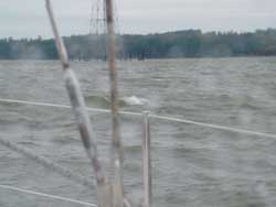
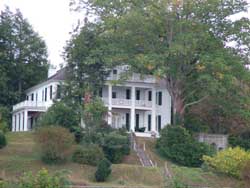
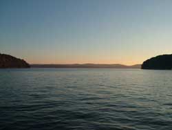
.jpg) We are leaving Green Turtle Bay.
We are leaving Green Turtle Bay.
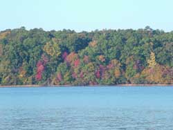
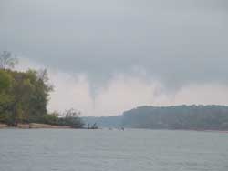
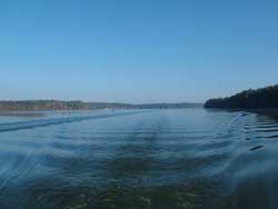
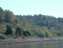
.jpg) It looks like we will follow fall to the Gulf.
It looks like we will follow fall to the Gulf.
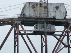
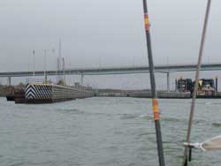
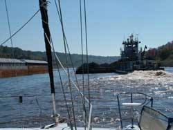
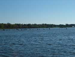
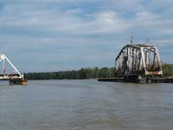
.jpg) One of the many barges we
will pass.
One of the many barges we
will pass.
.jpg) Our future awaits us.
Our future awaits us.
We had a head wind so we motored 2 hours to Duncan Bay where we had to fulfil the lyrics of a song Jim wrote where it says "Duncan, it will be one last night with you." Overall, we are excited, missing loved ones, relaxed, starting to plan for the next few days, and confident the cruise will go well. We will miss all of our close friends and family who are in St. Louis and around the country. However, we know we want to experience our dream so now the ball is in our your court. Come visit us. Go to the visitors page and look at the plan and see if there is a time you might want to visit and experience life aboard our Gemini 105M sailboat known as Sailing Vessel Freedom.
Follow along with us and we will try to update the site every few days.
| October 16 - Today I woke up a little before 7, started the engine, pulled the anchor and underway at 7:10 a.m. The day was WET to say the least. We had rain all day long and on the weather radio it said we were having a weather event. There was supposed to be 2-3 inches of rain and I think it was true. Visibility was at times down to a mile but other times would open up for 5 miles. At 9, I began to loose RPM on the engine and knew we had dirty fuel filters. I had expected this because of the amount of time we had the boat laid up working on it and the fuel was just growing things. I think we will have a few filter changes before we get to Mobile and the fuel clean. We were back underway at 9:45 a.m. so it didn't take too long. | 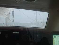 |
 |
We motored the rest of the way against a head wind. There were several times we saw 22 knots true wind coming straight at us. (For those who aren't sailors, to convert knots to mph, you need to multiply the knots by 1.15. So, we had 25.3 mph winds and probably a bit more with gusts.) What the wind does is slow you down (instead of 6 knots at the low we were only making 4.5 knots) and also create white caps and waves. It was a bit noisy inside because of the slamming against the bottom of the hull. A negative for a smaller catamaran with a lower clearance. This is true of the Gemini but you get used to it when you think about saving 60 or so thousand dollars for a larger boat. |
| We anchored in Hurricane Creek for the evening and are looking forward to drying out. Tomorrow, the weather will improve and we should make 50 miles or so. We aren't in a hurry but it will be nice to see the scenery pass. Wednesday looks like the "pick day" so we are looking forward to temps in the 70's instead of the 50's. | |
October 17 - We began the day again at 7 and got underway. Today started out just like yesterday with rain and limited visibility. It looks worse than you could actually see and today the worse was about 2 miles. The wind wasn't as bad today so we made a little better time. The reality is who really cares when you are seeing the world at 6-7 miles per hour... The operative word here is see and we hoping the weather improves today so we can see. |
 |
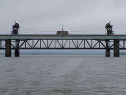 |
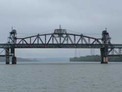
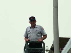
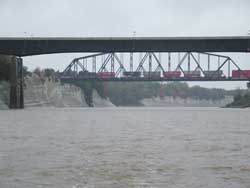
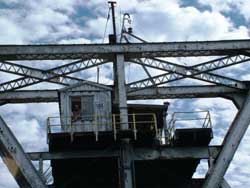
As we progressed, I saw in our cruising guide there was a railroad bridge at mile 100.5 with a clearance of 27 feet. This is a problem since we have a mast and our clearance is 46 feet. The good thing is that you can call the Seaboard Systems railroad bridge operator and they will raise the bridge. Just think, they did this just for our boat. On the left you can see it when the bridge is closed. (I took this after going under the bridge because I called a mile and a half out and they opened it before I got a good picture.) Then below you can see it open and also a picture of the bridge operator. The operator was very nice and waved as we went through. He also wished us well on our trip. |
 |
 |
| As we approached the bridge the rain was stopping and it actually got better. To the right you can see the clouds are beginning to part. In addition, in the distance you can see a couple of islands we needed to go around. We are about to enter the river section of the Tennessee River and the scenery will change. | 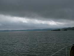 |
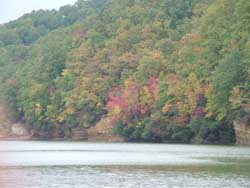 |
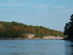
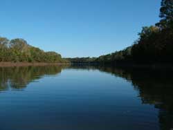
According to the cruising guide The Tennessee River Cruise Guide by Fred Myers, we began passing through the western edge of the Highland Rim at this point of our journey. You could see where the river cut into the hills and exposed the yellow rock. The views in this area were really nice with the fall colors. Wildlife is all around now. We have seen a few more boats today since people are starting to move without the rain. Yesterday we saw a total of 6 boats the entire day. |
| One of the people out today was working. You can just see in the back of this jon boat what looks like a bigger engine. In reality it is a gas powered air compressor which the diver, yes, the diver uses to provide compressed air to breath. You can see the diver is down and working to collect mussels from the bottom. Just imagine being underwater in what would probably be one foot of visibility in a wet suit dragging a bag around with you stirring up the bottom reducing the visibility to zero trying to find mussels. | 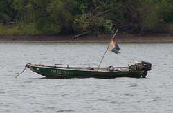 |
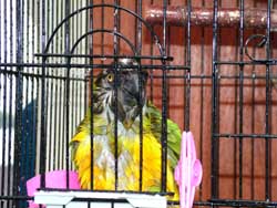 |
Well, everyone needs a bath. Jimmy Buffett decided to take one today. Sometimes he takes one himself and sometimes it is on my shoulder. The problem with when he takes one himself is he leaves a big mess on the floor by throwing water everywhere. |
Tonight we anchored at Lick Creek cove along the side of the river at mile marker 131. This means we made 55 miles today. The anchorage looked ok on the map but I soon discovered the channel wasn't very wide and we really could have used a better anchorage. Since the wind wasn't forecast to rise we decided to stay and dropped a rear anchor as well as our front anchor. I don't think I would use this again since the water is down 5 feet because of the winter draw down. Spring would be fine but not in the fall. Tonight we had a great meal of salmon on the grill and vegetables with potatoes wrapped in aluminum foil which cooks great. We didn't have good cell coverage during the later part of the day however, I was able to stand on top of the cabin roof and get a call off to a marina at Pickwick Lake. We decided that we will probably go into a marina for a night in another 3 days so we can get some exercise and shop for some fresh vegetables. |
|
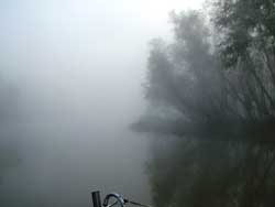
| October 18 - Today we awoke to fog. The fog was forecast yesterday on the marine weather so we expected it. That was fine because we had planned a short day today anyway since there wasn't an anchorage at 50 miles, instead we were looking at a 40 mile day. Even though we had fog, I was able to get underway and hug the right bank. I had about 1 mile viability at times and 3 miles at other times. Overall this was fine because the river is still wide. I went past three barges on the way. The picture at the right is as we left the fog. It was like magic, at one point is was there and then, it was gone. | 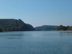 |
 |
The river is a very interesting place. You see the fall colors and you realize that for years and years the water has been cutting away the rock. It is interesting that the trees seem to be trying to hold up the bank, however, as you turn the next corner, you see the trees down in the water with no leaves and turtles crawling up on the trunks to warm themselves. Live is continuously changing and that seems to be the message of the river. Oops. About now we discovered that the fresh water pump isn't working anymore. After troubleshooting, I found the pressure switch is still good but the motor is bad. I watched the cell phone and finally found a good signal long enough to order a new pump from Defender (great service!) shipped to the marina we are staying at on Friday night (at least we hope.) Then at 1:30 p.m. we had another fuel filter issue which was about an hour and a half after I switched tanks. This time it took me 10 minutes to change both filters and we were off again. I expect to continue to have problems for another fuel change and then I hope it will settle out. I guess that is what you should expect if you don't use your boat and have those things growing in your diesel fuel. |
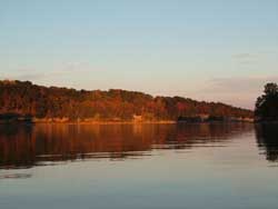
Deb was a great trooper today. She was at the helm as we were having the fuel problem and got stung by a bee. She said "ouch," at least that is what I will say here, and stayed at the helm as I pumped the ball to increase fuel flow so we could anchor and change filters. As soon as we were anchored she applied Benadryl cream and took a Benadryl All is well with Deb. We set anchor tonight behind Swallow Bluff Island at mile marker 170 after fighting an increasing current from .5 knots to 1 full knot. This slowed us down but still arrived in time for showers. This is a great anchorage since it gives you a great view of the waterway and it also is protected from the barges that will go by in the night. As the sun sets, the colors will deepen and the depth of the trees is amazing. To say the least, this has been one of our best anchorages so far. Of course it helped that it didn't rain and it warmed up to over 80 degrees today. |
 |
 |
This is the view from the front of the boat as the sun was over the horizon. To say we are experiencing a beautiful part of our lives would be an understatement. By the way, we had grilled Mahi Mahi along with vegetables and potatoes tonight. I think we really need to get off of the boat and exercise. Tomorrow we will fight a 1-2 knot current and go through our first lock. We plan to anchor out and then head to a marina for fuel, water, and if we can get a slip we will stay there. Otherwise, we will dingy in and do laundry and do some power walking. Sit-ups on the foredeck are not my cup of tea. |
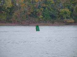
| October 19th - Another day in paradise. I was underway at 6:50 this morning just in case the "dreaded currents" attacked. For the first 3 hours there was less current than there was yesterday and then came the attack of the currents. When we were just north of Shiloh National Military Park and we were losing 1 knot to the current. According to the guide this will get worse before it gets better. In addition, it started to rain again at 10:15. I wanted to stop at Shiloh but there wasn't a way for us to dock or anchor our boat and then get to the park. Something we will have to plan for on our trip back up in a few years. As we progressed towards Pickwick Lock and Dam we continued to be attacked by the "dreaded currents." At times we were slowed by 3.2 knots. Now if you are figuring with me, that means we were only moving 2.8 knots or seeing the world at.... 3.2 mph. To the right is a picture of the rain, a home General Grant used as his headquarters during the battle for Shiloh and another showing the buoy which was bent over from the current. Lots of current. |
|
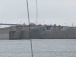 |
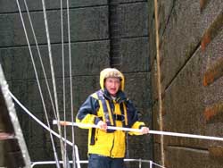
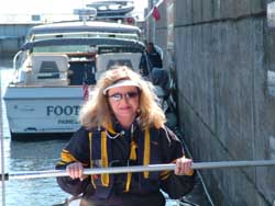
Our first lock was on the agenda for today and as we approached the lock we were passing a barge who was going slower than us. Yeah us. I called the lock and he told me that he had already told the barge to enter the lock. I pulled over to the side to hover (you have to essentially go the speed of 2.5 or so knots so you can stand still) and then another boat called in too who wasn't commercial. I think because there were two of us the lock master told us to go ahead and come in. Then another called and they caught up and went through with us. More about lockage follows. |
The lockage is something that Deb has dreaded because she hasn't done it before in this boat. To lock through, we have a midship cleat which I installed on a sail track and we are setup to secure the boat on either the port or starboard side. Deb must wear a life jacket because she is tending the lines. I will wear one just in case I have to help her out which I don't expect. The life jacket is one of those cool automatic inflation ones. If you fall in, it inflates. Also, we bought the kind that has rings so we can use it later with a tether to ensure we don't fall overboard. Protection in two ways. |
 |
 |
In this lock we went up to get to Pickwick lake. The lift was about 55 feet and it was a bit turbulent since they are letting water into the lock. The real problem however was the wind from our back which was pushing the boat around a bit towards the front. Yep, Deb had the work to do. The guy to the lower left was the lock master. A really cool guy who knows that he has to take his job seriously. We talked to him at times when we were coming up. He loved it that this was our first lock and that we were heading off for the adventure of our lives. He also smiled for the picture. Deb liked him because he said she did a good job. |
 |
 |
We made it through. Now we are heading off to our anchorage for the evening. We are going to a cove just past the marina we will check into tomorrow so we can do laundry and pick up some fresh veggies. Also, we need fuel and a bit of water. To celebrate the 1st lock we had champagne and of course tonight is Pizza night. I make good pizza on the boat. The link you see is to the recipe portion of the site that shows you how I do it on a boat. I've already had people call and email about seeing our trip. Thanks we love email. Also, sorry about not updating for the last few days. Cell service wasn't working except sporadically. And then as I tried to update the site on Thursday, I wasn't allowed on the digital network. So this is probably going up on Friday when I have access to a land line or wi-fi service. We will probably get into an update mode of every two or three days because I'm sure the excitement will wear off a bit and besides, do you really want to read about everything we do everyday?? Update: Wouldn't you know it, the cell didn't work because I wasn't recognized on the network. I'll have to call Friday. Regardless, we watched an episode of the X-Files, Deb's favorite, and then Captain Ron. If you wonder what we are up to, besides me showing almost everything, then watch Captain Ron. It is an adventure. |
 |
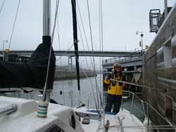
| October 21 - We stayed at Grand Harbor Marina last night and it is a great place. They made a place for us right next to the laundry facility. Deb liked that. Price was good too at $1 per foot so for us it was $34. They also provided us a courtesy car and we were able to pick up a propane fill in town. | 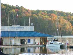 |
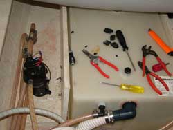 |
Of course when you go into a marina you also have to fill up all your diesel tanks, pick up gas and water. Then you must abuse the water and wash your boat too. Of course, you plug in and run the heater because it was cold. Well, remember the water pump that went out. Defender shipped it as promised and it was there on Friday afternoon. Therefore the next project was to replace the pump. Sounds easy but bottom line with projects is always, you need more tools. |
| Ended up the screws were striped out so a phillips screwdriver wouldn't work. I had to cut off the rubber feet and then was able to get the screws out so I could replace the pump. Ended up all was well and the new pumped worked better than the old pump ever had. That must have meant is was going out before I knew it was. | 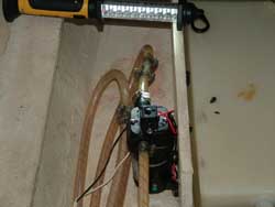 |
 |
THe picture to the left is where we turned on Pickwick to go down the Tenn-Tom waterway. It is at this junction that Tennessee, Alabama and Mississippi boarders meet. As you can see below, the trees are still changing color for us as we move south.
|
 |
We are about to leave behind Pickwick Lake. To the left was our view as we looked to the rear of the boat. The next section was to be the cut through the Continental Divide. |
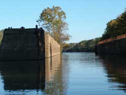
| This is a very interesting project. I know what my taxes have gone towards for the last number of years. I don't know what it cost, but I'm sure I'm still paying it off so I could use this waterway. In our guide it says the cut is 280 feet wide bank to bank and this is where it starts or ends depending on your perspective. | 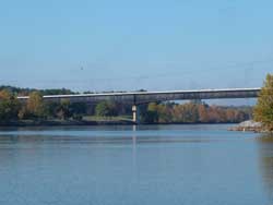 |
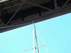 |
The bridge you see above has a clearance of 52 feet or so it says in our books. Our mast has a height of 46 feet or so it says in our owners manual. I never measured it but I have to say I did look when I went under the bridge. It sure looked less than 6 feet of clearance but I'm sure it was actually more. |
One of the things you need to stay alert for in the waterway is tows or as we called them back in Missouri, barges. Now having one is close enough for me but when you have two and you are trying to pass one then you probably should slow down. I actually figured out who would win in this battle. Before we met the second tow, the captain of the tow in front of me told me to pass on the two- that means on his port. After we passed the tow from the other direction then we had a curve in the waterway coming up to the right. Now I was asked to pass on the one which meant his starboard or for the landlubbers, the right side. Now is not the time for a fuel filter problem by the way. |
 |
 |
At one point in the waterway, I understand they had to cut down through 100 feet of the divide and of course they also had to cut the channel so we would have our minimum of 9 foot but mostly 12 foot or so of water. Sounds like they moved allot of dirt. |
| Then as soon as it began, it ended and the scenery changed again. | 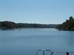 |
 |
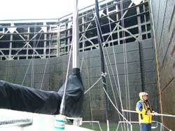
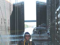
Next was the largest lock we would pass through. Look, Deb isn't looking like she is screaming for help. She is actually smiling. I think she has it. Next you see the doors closing. We are trapped inside a lock and is is a big lock. I hope the doors don't break! |
 |
 |
|
 |
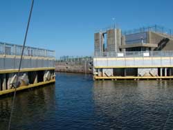
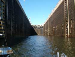
As you can see from the pictures above. We were at the back of the lock and as we went down the 85, yes I said 85 feet we looked up about 9 stories at the gate which is above a concrete base. I guess the concrete base is to keep in most of the lake in case the gates fail. Also, it could be that they saved money by building smaller doors. I'll bet it was both. On the right you can see how deep the lock actually was. This is pretty cool. Again, our tax dollars at work. By the way, this lock is called the Jamie L. Whitten Lock and it is at mile marker 411.9 on the Tenn-Tom Waterway. |
 |
 |
The world has changed. Starting at this point the landscape has started to change. There are lots of old trees on the side of the waterway which means that you should probably stay in the channel. On top of that, the hills aren't as high. We are going to start dropping in elevation since we are going downhill from this point on. Thus, no more attacks of the "adverse currents." At the end of the day, we were at mile marker 400 so we made 50 miles today. We are setup to go through the next lock tomorrow and should be off early with a Trawler who joined up with us and at our speed at the Whitten Lock. By the way, tonight was Pizza night and if you click on Pizza, you will go to the recipe page where I tell you how I adapted cousin Julies method of making a pizza to one that I think rivals the best of the ones you buy. |
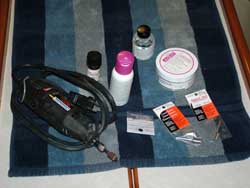
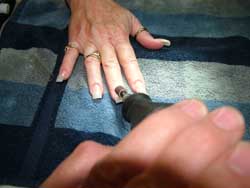
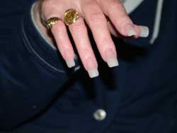
Nails! Did someone ask about who was going to do Deb's nails? Yes, it looks like yours truly, Jim Faughn, will be doing Deb's nails on the little 6-8 or so year trip. I figured if you can build an airplane you have to be able to do nails. So, with my trusty dremel tool and a few supplies and more tools, this was the first night to do nails. Well, let me tell you, the first job wasn't too bad according to Deb. Of course I think a little practice is in order and I also think we will be doing them OUTSIDE next time because of the smell. |
 |
 |
 |
October 22 - No pictures today. Not because we didn't do anything, it is only that you've seen it before. Today we were off at 7:30 only to wait at the lock for 50 minutes. That is the life as you move through locks. It ended up they weren't slow, they were waiting for another pleasure boat named Viper who was on his way. They try to get as many boats moving together so they don't have to run the locks up and down for a couple. We were then off for what we thought would be to go through 5 locks and then anchor. We made it through another lock with Viper leaving us behind. Well, guess what? At the 3rd lock who was tied up. 90 or so foot Viper who was held back because of a Tow boat that had priority. Ended up his speed didn't pay off. We locked through together and then we had to wait again at the fourth lock for the same Tow. This time the wait was for over an hour so we anchored and waited. Again we all locked through. Ultimately we passed the Tow but it was getting late in the day. I called the next lock by cell phone to tell them not to hold the lock for us because we would be anchoring for the night. Prancer, the trawler we were running with, along with us made an anchorage at 358.2 before the Aberdeen lock. Ended up this was a pretty cool anchorage. It is on the west side and has a well marked channel taking us to a park which had a dock. We tied up to the dock and took a walk to get our legs stretched. When we got back, we pushed off and went out to anchor so we could run our Honda Generator (2000i) and also the heater. It is to be in the high 30's tonight. We should be off tomorrow for Columbus Mississippi to see the town on our bicycles and pick up a few things. We plan on getting off by about 8 am, lock through and then arrive around 12. We will see how it goes. As a side note, I also have just begun to realize we aren't on vacation. I was watching the landscape go by and actually enjoying the entire experience in 55 or so degree weather thinking that we are on the journey of our lives. We actually live on the boat of our dreams and this is home. To use a phrase from a book I read, "home is where the boat is." I think that phrase will suit us very well over the years as we discover landscape, people, cities, states and countries we would have never been able to experience without this journey. |
|
October
23 - I guess I should have taken one of the thermometer last
night at 2 am when I got up and it was 51 degrees in the boat. If there
is one thing Deb hates, it is being cold. I knew that I needed to fuel
up the generator, or as Deb previously called it, the Jim-a-rator. I filled
up the tank and then got it started and of course turned on the reverse
cycle air-conditioner. This worked like a dream in about 30 minutes. This
morning when I got up, it was 68 degrees in the boat which was what I
set the thermostat for. I turned it up to 72 so it would be warm when
Deb got up. She was happy, I think we will rename the generator the Deb-be
Happy. Ok, Debbie - Deb-be, I'm not that great at humor. We left our anchorage
after calling the lock at 8:10. They were doing some maintenance so we
weren't supposed to get to the doors until 8:25. We arrived on time and
they had the lock ready for us. We locked through and then settled into
a 3 hour 45 min run to the marina we were staying at for the next 2 nights.
As
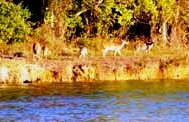
we were at anchor we saw 5 deer on the opposite bank. They were feeding
and evidently were used to people on boats. I heard from the gentleman
at the dock there was also an 8 point buck that also visits these does. |
|
| October 24 - We were in the Marina all day today and it was nice because it was cold and raining off and on. We made it to town which meant that we went to pick up some supplies in the courtesy car and picked up some supplies and mailed a few items. In addition, we found the great homes we read about and wished we had more time to see the old town of Columbus. While we were driving we also found an anchorage near the old town which we will stop at when we head back up the waterway. There is also a small dock under the railroad bridge that we could dingy in to. The new anchorage will be a must stop on the way back up the waterway in three years. | |
| October 25 to 26 - We were underway again today. The first thing we did was go through another lock and of course it was cold and later it was raining again You've see locks but if you look at the lower part of the steel structure above the concrete you will see a blue heron picking up a fish that was caught when the water was lowered. I guess we all adapt to the easiest food chain. Next time you order an appetizer instead of hunting rabbits, you will know what I mean. | 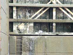 |
 |
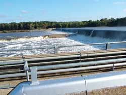
After we went through the lock you could see the water coming over the spillway. As you look at the picture to the left, you will see the water over the spillway and you might even see some of the spray on the right. Skip over a bit and you will see the lock we just passed through. What you don't see is it is raining again and it is in the low 50's. Thank goodness I built a nice enclosure for the rear of the boat. |
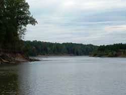
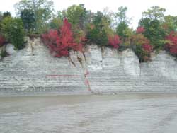
The scenery has definitely changed. We are now in the Tombiggbe river and they have only made a few cutoffs. Overall we are now following the river down to our next stop, Demopolis, AL. The river scenery is very nice although it is repetitive. Since we are seeing the world at 7mph then it really doesn't matter. Rain, cold and running to where the weather suits my bones. Below you will see that we passed around one of the bends and found the interesting white bluffs. The picture on the left was pretty cool because of the red leaves were falling on the bluff looking like the land was bleeding into the river. To the right, we just happened to catch a freight train passing after we went past the white bluffs. |
 |
 |
 |
October 27 - Last night it was raining (so what is new) I avoided a mutiny on the boat by making 67 miles in one day and 55 the next to make it to the Demopolis Yacht Basin. Deb needed to be warm The Deb-be happy or now called the Deb-be happyrator worked but trust me when I say, time was running short and we needed some time for entertainment. We spent the day doing typical boat things after the rain quit at about noon. Shopping, going out to lunch and then going to happy hour at the restaurant at the marina. We met several local people who added a great deal to our visit. The marina is basic if you read between the lines. However, the people are very nice. It looks like we are off tomorrow morning. Our fuel and water are filled and tomorrow we pump out. Then we are off to continue down the waterway. We expect to be in Mobile in about 6 days. I don't know how often or if we will actually be able to update the site until we are in Mobile. Regardless, we finally have a weather forecast that "suits our bones" It looks like the rain is over for the next 4 days and by Tuesday it will be in the upper 70's. This means tee shirts, shorts and happy times are ahead. I'm sure the blue sky's will be a welcome relief. By the way, thanks to those who were concerned about our older fuel, thanks for the input and advice. We haven't had to change a fuel filter since the 2nd one so I think we are over the hump. We are getting 22 hours of run time on 16 gallons of fuel. This means we are getting about .73 or I should just say 3/4 gallon per hour running 2650 rpm and making about 5.8 - 5.9 knots according to our knot meter. GPS shows higher but that is because of what is now a boost from the downhill run we are now making. We will change our filter again at the next scheduled oil change which looks like it will be a little after we reach Mobile. |
|
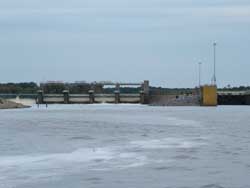
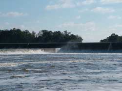
October 28-31 - We filled up with fuel on the 28th and were away by 8:10 then out to the lock. They brought it up for us and we ended up waiting on Prancer so we didn't get into and then out of the lock until 9:20. That is just the way it is with Locks. Sometimes you catch them right and others you don't. However, we are now starting to benefit from all that rain and we caught a boost of current. This time they were aiding us and even thought we were only seeing about 6.2 knots on our knot meter, our GPS was showing 8.2 knots at the peak. We will pay for this on our way back in three years. To the right you can see the water coming over the dam at Demopolis. I stood on top of the cabin and held my camera over my head to take the picture. |
 |
 |
Again, you can see the water coming down to help us on our way. From this point forward on the Tenn-Tom waterway, there aren't that many anchorages. So you kind of have to pick where you think you can get to and then leave accordingly. However, Locks play into that and if one holds you up, you may either have a long or a short day. We ended up with a long day today. |
| We anchored overnight in Bashi Creek at the 145 mile marker. I'm giving a few mile markers now for a fellow Gemini Owner who will be making the trip down in the next month. Bill Burg on Tortula, I hope you get these. The entrance was about 7 foot when we entered and since Prancer went in first, I knew it wasn't a problem. By the way, Prancer runs about .75 knots faster than S/V Freedom does so we typically end up coming in later. We anchored late in the afternoon and made the 71 mile trip. This was a record for us and we are really looking for 50 or so mile days. Again, we don't have many anchoring options so we take what we are given. Perhaps that is another life lesson. | 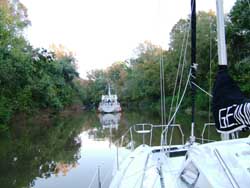 |
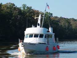 |
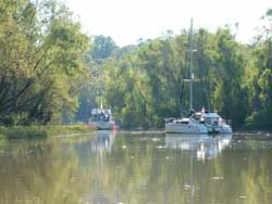
I've mentioned Prancer a number of times so I thought you might want to see the boat. Above you can see her anchored in front of us and then to the left is a shot as she is about to overtake us the next day. On the 29th, we were trying to get away early but fog had set in. It delayed our departure for 2 hours and we got underway at 7:40 am. Don't forget we set the clocks back last night so this fog just cut out one of our anchorages we were thinking about. |
| This is the LAST lock. That is Deb screaming in elation. She even told the Coffeeville Lock Master and he was happy for her. We are heading for an anchorage at mile 100 called Old Lock #1. The guide says don't trust it because of shoaling. However, I went in first this time ( I draw less water) and found they must have dredged the entrance. I saw 18 foot of water at the entrance and we anchored in 14 foot. However, next time, I'll inch back further because it was beautiful where it opens up. | 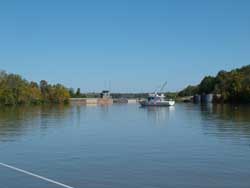 |
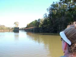 |
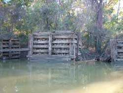
Because this was an early day to anchor, we put together the dingy and went for a short ride. When we went around the corner we saw the old lock #1. I don't know when this was built and it would be cool if someone found out and sent it to me so I could include it here. Regardless, there was a boat ramp on the right and a park up the hill. |
Instead of building everything out of concrete, they build the mooring cells out of timbers and then filled them with rock. I guess it worked well enough. I'm guessing the entire structure was built sometime back at the turn of the century but we will have to find out. Below you can see a picture as we passed through the old lock and then it opened up again. |
 |
 |
 |
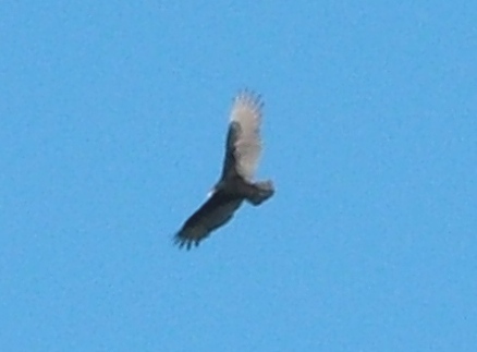 |
We weren't the only ones in the area. This bird was riding a thermal and my guess is that he was looking for a school of fish so he could have some dinner. |
This shows where we were anchored. Since I was first in, I was in the back. Prancer is facing the waterway. Since we had the dingy together, we also went over to their boat for happy hour. Earlier in the day, we had stopped at Bobby's Fish Camp so I could fuel up just in case. We were early and they didn't open for lunch until 12. However, they said they would make us lunch anyway. We had the Seafood Sampler and it was LOTS of food. Deb and I had it for lunch and then took it with us for happy hour. We barely finished it off. Thanks to Bobby's for showing some southern hospitality. Also, thanks to Dave and Betsy because they had happy hour food plus some cake for us from Dave's birthday yesterday. |
 |
 |
Our thoughts for an early start this morning were met with, yes, Fog. |
It is hard to get an idea with pictures sometimes how bad the visibility is in fog. So, I also took a picture of Prancer who was about 100 yards away at the most. You can quickly figure out why we stayed on anchor. When I actually received a cell signal I also called Boat US and changed my cruising area effective tomorrow, the 31st. Now I'm insured for the next phase of our trip. It was a good thing too because we quickly lost cell coverage. The fog burned off at 8 am so we were able to get underway and made another good day. We got anchored at 4:15 pm and made a 63 mile run down to Tensas River. We anchored close to one of the bends. |
 |
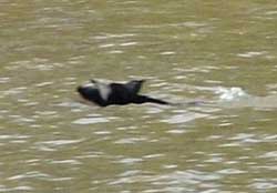 |
Halloween - October 31st - Today was an early start so we could make Dog River in Mobile Bay early afternoon. I was under way at 6 am. Deb was up at about 7:45.... Life is good for all. As we were making it down the waterway and clicking off the miles to 0.0, I saw something swimming across the waterway. I thought it was an alligator and called for Deb to look. Then I went for the camera. Of course as I got closer I thought, that doesn't look like an alligator and it may be something else. The picture shows it isn't a dog, a deer, or a cow. |
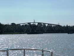
Ends up it was a wild pig and that is a razorback. It is amazing what you will see on the waterway besides trees and other vegetation. As a matter of fact, we have gotten quite used to the solitude of no civilization and an occasional house along the way. As we got close to mile marker 13.4, we encountered the 14 mile bridge. This bridge is about 4 feet above the water and as you have already figured out, that is about 44 feet too short to allow us to fit through. We called and they said they would open it for us. To the left below, you will see it swinging open and to the right, you see the operator smiling and wishing us a good trip. |
 |
 |
 |
 |
After
we passed by you can see the "swing bridge" fully open and again,
that was just for us. It is amazing to us how accommodating everyone is
to the boaters as they use the waterway. |
| As we turned a corner we saw the industrialization of Mobile. It was very obvious there was quite a bit of money being made as a sea port in Mobile. We didn't put allot of pictures about passing through this area but I have to tell you, this was a trip. We had boats everywhere. We just left an area that had nothing and then we motored through the busiest area I've ever been through. Extremely large shipping vessels from all over the world with the names on the stern of the boats. All were being loaded or unloaded at the docks. In addition, there were also boats being build including a new boat for Balley's Casino and others being worked on in dry dock. |  |
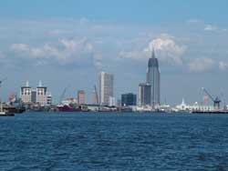 |
It
seemed that as soon as we arrived, we were leaving the sea port area of
Mobile. This was a very dense area and it was amazing that our little
boat - a Gemini 105 named Freedom and owned by little old Jim and Deb
Faughn was cruising through this area. As soon as it began, it ended. |
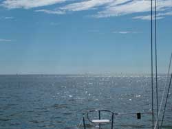
And now......we are in salt water and this is the view we had. No land in front of us and the only thing we had for navigation is the GPS and the markers marking the channel. For our friends who don't know, at this point we are following a shipping channel that has red triangles on the left side and green boxes on the right side. This shows us the way down Mobile Bay and the depth is deep enough for major vessels. We were heading for the markers that would provide access to a channel to Dog River where we would anchor for the evening and launch the dingy. We went off and bought new flares (need to be legal) then back to the boat. After doing another nail job, we were off for dinner at a nice restaurant We figured that since we didn't go to a marina, we would go to dinner. Ok, it doesn't work all of the time but it seemed like a great celebration for the end of the Tenn-Tom waterway. |
 |
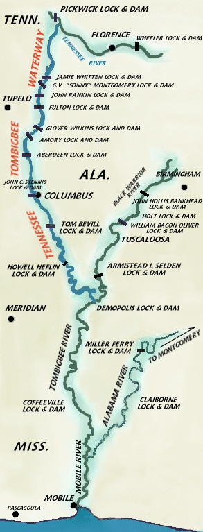 |
This is for the many people that have asked about where we were going. This is a picture I found on-line that shows the Tenn-Tom waterway. Of course it doesn't show the part we traveled from Kentucky Lake to Pickwick Lake, but it does show the remainder of the trip to Mobile. Overall, we have traveled about 600 miles with 450 miles on the Tenn-Tom waterway. We still have many miles to go but the bottom line is we feel prepared, our boat is running well and is prepared. Now it is simply time to live our dream. We are truly enjoying our lives "Seeing the World at 7 Miles Per Hour." We hope you are enjoying our website and let us know your feedback. Jim and Deb Faughn |
Web Page by Jim Faughn