April 15-31, 2009 - Cruising Log for S/V Freedom - a Gemini 105 - Jim and Deb Faughn
Previous Log - The most recent past log
All Logs - This takes you to the list of all of our logs
 |
Apr 16 - Our wonderful friends, Steve and Linda (photographer) along with Keith, delivered the Beetle you see in the lower left side of this picture. Deb, looking like a nun, is accepting the key to the Beetle in the new handing over of the Key ceremony along with flowers that is becoming an annual event. The crew of Steve, Linda, and Keith are heading south to Florida and Sun-N-Fun which is an airplane event which almost rivals Oshkosh. You might remember that we saw them at Lakeland about 2 years ago when we headed up the east coast. We really appreciated the fact they brought the Bug down for us to use this summer while I get to help out on the sailboat sales program at Green Turtle Bay. |
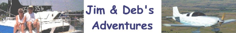
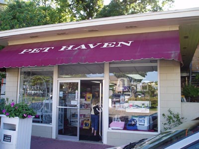
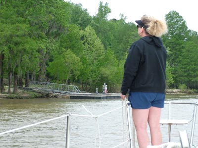
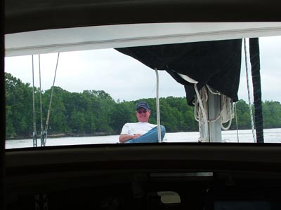
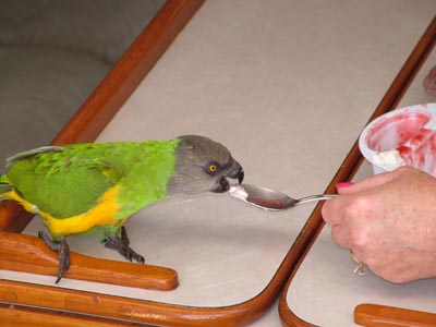
We took off on tax day, April 15 heading back to Fairhope, AL. Leaving at 7 a.m. we were trying to get to Fairhope in time to pick up Jimmy Buffett at the Bird Sitters. Deb had called and Jimmy was pretty pissed at being left behind. At first he wasn't coming out of his cage and was turning a cold shoulder or should I say wing at the people of Pet Haven. Ultimately, he decided that he would come out of the cage and he was looking good when we arrived. you can see Deb is essentially "running in" to the store to check on her bird. As you can see below, Jimmy Buffett was just fine and we heard a bunch of stories about how he was performing for his audience when the kids would come to look at the mice and other animals kept where he was in "storage." Deb was happy to get Jimmy back on the boat and we found the boat in wonderful condition. |
 |
 |
 |
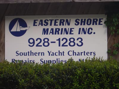 |
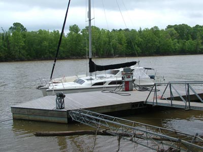
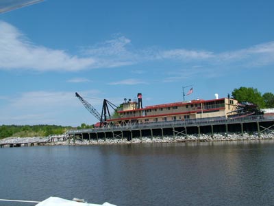
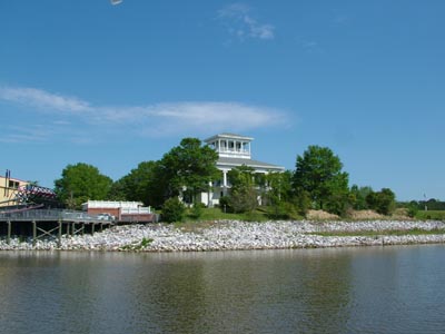
We stayed at Eastern Shore Marine and they have a great small marina. Ed owns the place and I think Mary really runs it. They are both wonderful people. If you are heading south on the Tenn-Tom, you won't make a mistake by stopping here to pick up fuel and of course to stay several nights. The town of Fairhope is a great place to visit and it will make the start of your cruise south a great start to southern hospitality. Speaking of southern hospitality, I can't say enough about the help I received from Bob, Tom, and Dick while here. Bob and Tom both checked Freedom to ensure we didn't have a problem taking on water. Evidently, the temporary repair with underwater epoxy has held. Now to see if it holds as we move north. Sounds almost like drama doesn't it! Below you can see a picture of a Shucker. This is the same kind of boat my friend Garry has purchased. I won't go into the details again but Garry and Shirline have stripped the boat, painted it, getting ready to put in a new engine, transmission and all the other stuff needed to make it a great boat. Now you know what it looks like. |
 |
 |
 |
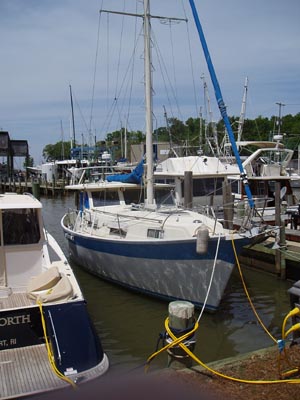
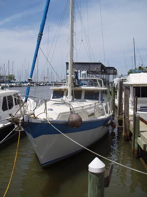
The picture to the left is a gaggle of Gemini's. The one to the far left is a 3400, then there is Bob's Gemini and the one to the right is Freedom another 105. What you don't see is a 3200 that showed up yesterday and is heading south. Gemini's are everywhere and especially where there is cruising to accomplish. |
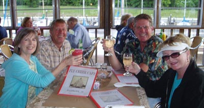
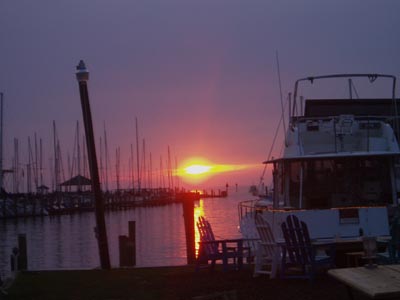
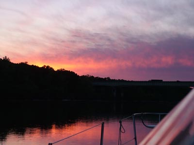
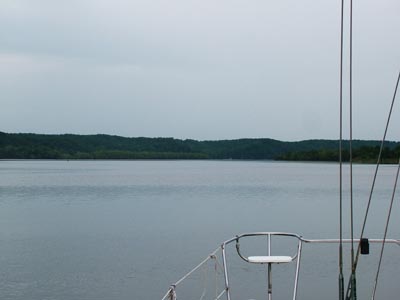
So this is what we are looking at in the future. We are leaving first thing on Friday morning. Fortunately, we now have the tide with us. The tide at Mobile will be coming in starting at 6 a.m. on Friday morning. Given this, it appears the huge current from the flooding will be backed up with the tide and should help us get north. I'm HOPING for a speed of about 4-4.5 knots against the current of the water coming south even with the tide with us. If we can make 40 mile days once in the Tenn-tom in 10 or so hours, I will be happy. All we have to do is get north of Coffeeville and then things will settle down. I'll show you in just a few pictures that we have LOT's of water to get through. Tonight we went to dinner again with Bob and Terri over at the Fly Creek Cafe. The food is excellent and the owner, Randy, is excellent too. Of course I just had to take the picture of sunset over Mobile Bay. I just don't know if I took it because it will be the last sunset over a bay or large body of water for quite some time or if I took the picture just to get my friend Garry going again about sunset pictures. |
 |
 |
 |
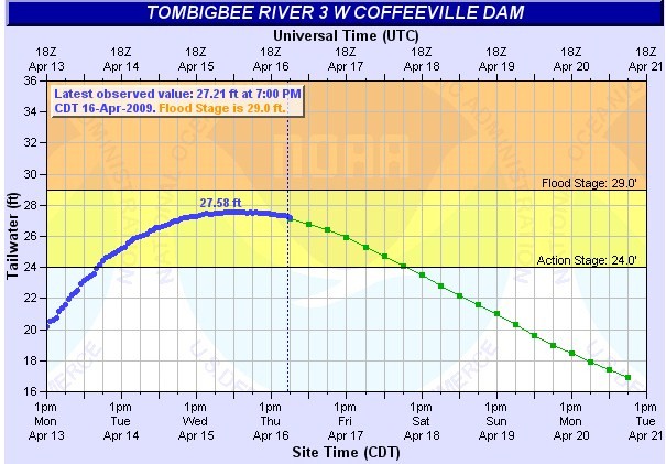 |
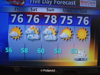
So for those interested in the real scoop, here it is. We arrived on Wednesday and the water was cresting at the Coffeeville Dam. This chart is of the tailwater, which means the foot of the dam. What you see is that they are forecasting the water to go down. To once again, put this in perspective, the water is supposed to be 3.5 feet. So the water is HIGH!!! We are going up anyway because we don't want to be stuck down here for another month or two. The rain has been beyond expectation this year and we are moving north. Now here is the real issue. They don't forecast the water level beyond what the rain forecast says for 24 hours. Rain is forecast for Saturday, Sunday and Monday. That isn't included in the forecast you see to the left. However, I've watched, watched, watched, and of course watched the weather forecast and it is my opinion that the rain isn't going to be that bad so we are going north. Hopefully the trees that were coming down the river will have already come south and we won't have to avoid that many of them. I really think I hoping here. It will be an interesting trip north and I think interesting is an understatement. All we really have to do is get north of Coffeeville and I think we have it made. We've already planned a place to ride out an extra three days at anchorage if we have to. Tomorrow the trip up the receding flood begins. I'll just bet that you are thinking, Jim, this is getting interesting again! Stay tuned. When we get wi-fi again we will update and you will get the real story. Did we break something like the outdrive, did tree's hit us while anchored and break us free in the middle of the night, did we only make 3 knots against the huge current, did we have a no-event trip? All good questions and I hope one of the answers doesn't involve calling our friends at Tow-Boat-US. By the way, if you don't have unlimited towing, get it now! I almost forgot to mention. I am expecting it to take at least 4 days to get to Coffeeville Dam and Bobby's Fish Camp for fuel. Then it will take another 3 days to get to Demopolis where we just might get wi-fi however I doubt it. So it could be 10 or so days before you get an update. I hope not but believe me the next one will be a good one! Don't worry, I do have unlimited towing.... |
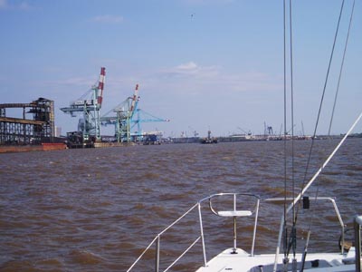
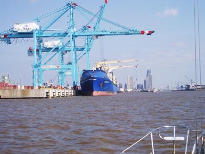
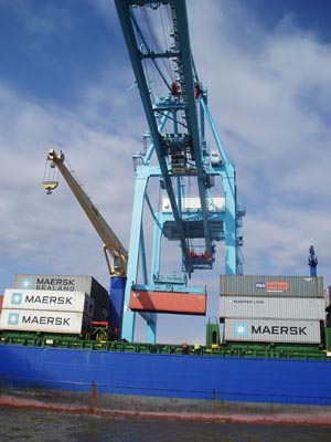
April 19 - I'm writing this at anchor in Bashi Creek. We are anchored in one of the most narrow of narrow anchorages. The muddy bank is about 15 feet off of our port side and about 30 feet off of the starboard. I would say it is protected. As we approached Mobile, for the second time, the scenery didn't change much. This is a busy seaport and one that must be respected. We were passed by the tow you see in front of us as we came into the port. One of the things I am continuously amazed at is the presence and lack of presence of security each time we enter a port. I'm sure people who are much smarter than me have determined where and when to apply much tighter security. Below you can see a ship being loaded both from the bow and also from the port side as it is being loaded. I actually tried and achieved a picture with the container in the air while navigating the port. I always think the loading of these vessels with the large cranes is interesting since the crane doesn't move horizontally. They must move the ship an exact amount to load the containers properly. |
 |
 |
 |
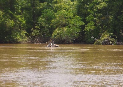 |
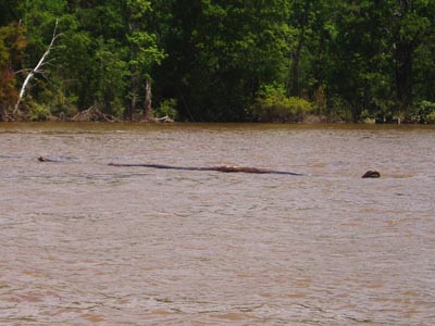
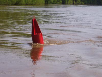
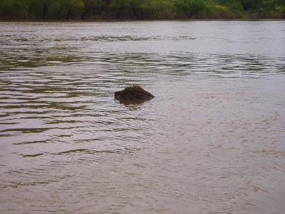
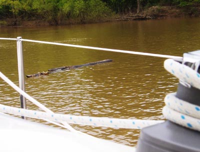
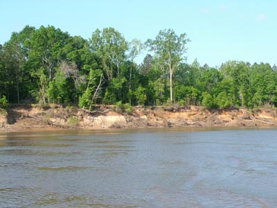
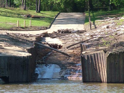
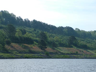
As we moved up past Mobile, there were quite a few "items" in the water. Items such as tree stumps, entire trees, logs and of course not to mention all of the other limbs and other pieces of woodwork that were chopped up by the tows are floating by. All can say is avoid them. |
 |
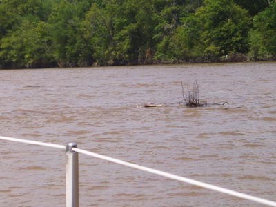 |
We had a great motorsail out of Fairhope for about two hours. Then we hit Mobile. I can say we slowed down. Just as a point of reference, we normally travel at 6 knots which of course is about 7 miles per hour. Our boat still travels at that speed even if there is a current against it, however that doesn't mean that we are traveling that fast across the ground. The current we have faced has been about 2.5 knots while traveling between Mobile and the Coffeeville Lock. Now if you are thinking math, you are quickly subtracting and figuring out that we are only moving about 3.5 knots when in the current. I on the other hand don't want to travel in the current. So I decided that since the water was almost at flood stage, we would instead use our old river skills and cut all of the corners on the opposite side of the current. That means that we are working our boat on the lee side. We have plenty of water and we have been able to achieve a 4.2 knot average of boat speed moving up to the first lock. By the way, you can see some more trees and large logs below. |
 |
 |
 |
 |
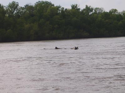
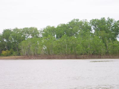
We actually planned on having a problem with rain on Saturday night and Sunday all day. However, even though we planned on the problem I also saw that the front was breaking up in the middle. That meant that if we could get far enough north we would be in the break of the front. Of course that meant that we had to be right. We traveled for 11.5 and 11.7 hours on both Friday and Saturday just to get to the old lock where we could sit out a storm in case I was wrong. Traveling at the speed we were traveling is extremely boring except for the part of avoiding logs. Below left you can see the brown mark of the higher water that has been up for quite a while. Fortunately, we were right in our decision and the water continued to drop and we were right at the gap in the front. Of course there were still logs to avoid. |
 |
 |
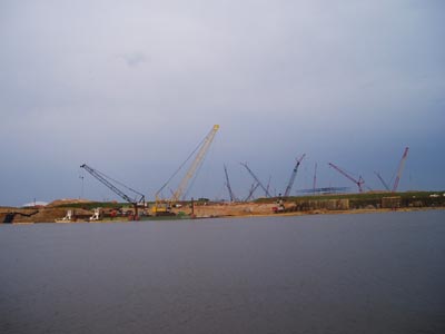
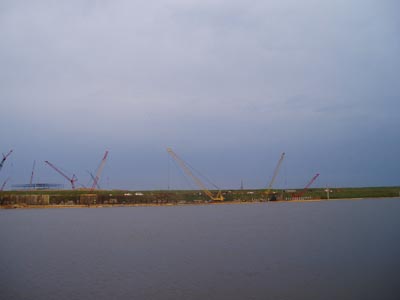
| The scenery is very industrial in the southern part of the waterway close to Mobile. However, since we were down the waterway in October, there is also more construction going on as you can see in the pictures below. I'm not sure what they are building but I counted 19 cranes and I'm not sure I was able to count them all. | 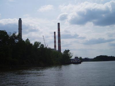 |
 |
 |
Just
as we were about to anchor we had a call on the VHF radio. You will never
believe who this is riding the current south. Steve and Pam are heading
to the Bahamas for a quick trip on their classic sailboat. I'm not sure
who the third person is but if I know Steve and Pam, they will have an
absolutely wonderful time. Steve told me he was doing 9 knots at time
so that meant he was riding the current while we were opposing it. All
I can say is fair winds and have an absolutely wonderful time. We will
see you in late June when you return. |
|
 |
 |
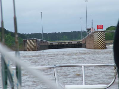
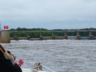
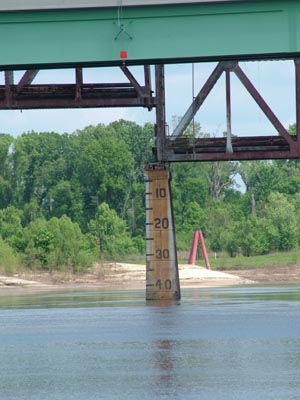
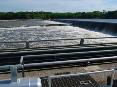
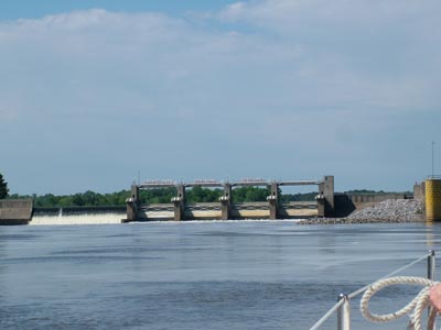
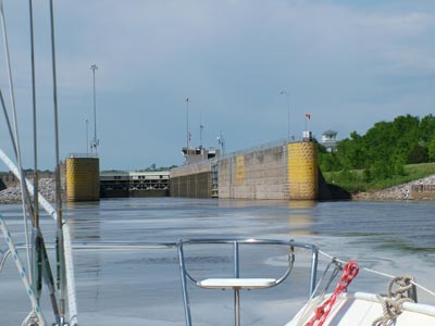
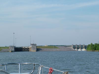
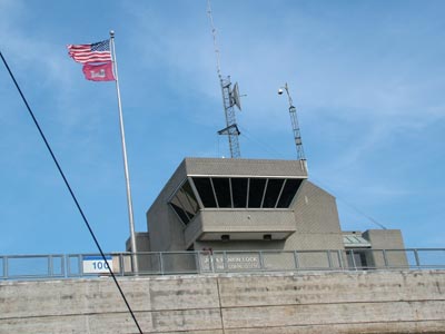
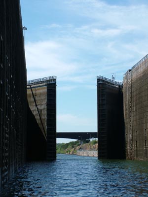
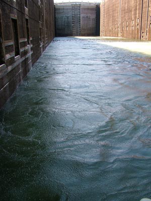
| Coffeeville Lock is designed for a 34 foot lift. In the picture to the left you should get an idea that we aren't going up that far. In the picture to the right you can see that they are letting quite a bit of water through, thus the current and high water. We are supposed to be at 3.5 feet above sea level right here and instead we are at 22 feet. It isn't flood water but it is high. | |
 |
 |
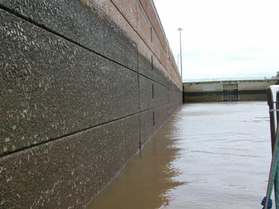
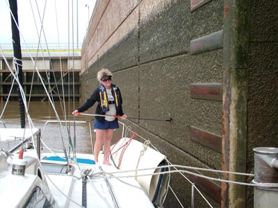
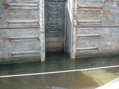
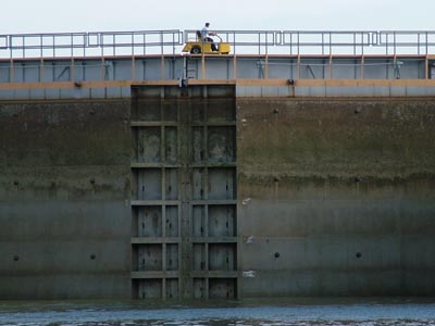
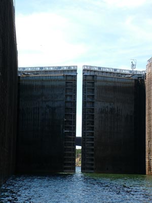
| Each line in the lock represents 5 feet of lift. The dark part is the amount we are getting ready to be lifted. It is about 9-10 feet. Of course I have to get the obligatory Deb working the foredeck with the boat pole. Isn't she cute! | |
 |
 |
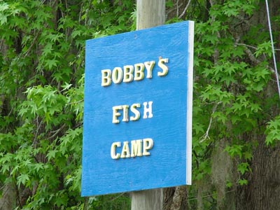
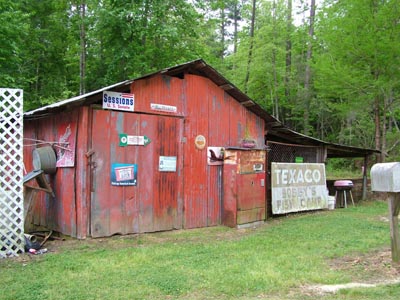
By now we are running a bit low on fuel. Truthfully, we don't have enough to make it to Demopolis. If the current wasn't so strong then we would have enough. Life just happens and if you need to spend money you should spend it at a small enterprise such as Bobby's Fish Camp. You can see us approaching the HUGE dock to the right. Then you can see us tied up to the HUGE dock below. |
 |
 |
 |
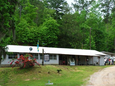 |
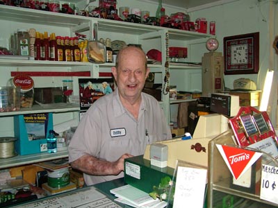
I just wish we would have been able to get here on Thursday, Friday, or a Saturday because that is when they cook. I'm told the fish is wonderful and when we come back down, we will ensure we are here on one of those nights. Who knows, perhaps they will get some free entertainment too. Don't you just love a place with character? Meet Bobby below. |
 |
 |
I just had to take a picture of the dock to the right. If you've been reading our website long you will know that when we came down in October we didn't have an anchorage and tied up to a dock when the owners weren't home. You guessed it, this is the dock. I skipped it this time. Below you can see a picture of the path we have to take. bottom line is that we traveled about 15 miles on the water to make 4 miles if you were a bird, should I say Jimmy Buffett, and flew. Such is the life on the river. Bottom right you can see that when Deb is helming the boat that I'm keeping a close eye on her. |
 |
 |
 |
Apr 22 - What do you do when you are in a lock and the pin that you tied to gets stuck? Oops, once again, I'm getting ahead of myself. I'll tell you about that in a bit. I have been so intrigued with the fact so many trees have continued to come down the waterway. I keep wondering where do they come from? Do they just manufacture trees and throw them into the water so the next flood you can avoid them? Is this like a video game that someone wants to invent? So I watched and watched and decided that it was the simplest explanation. When the water comes up and the current increases, the bank starts giving away and of course the trees start coming down for the next time the water comes up.
|
 |
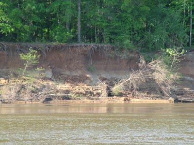 |
I've pretty much decided that the first time of the year when you have high water that you should definitely stay off of the water. The reason is that these trees that you see to the left are getting ready for their part of the waterway game that you are getting ready to play. I on the other hand will let someone else play that game. The time to run the river in high water is after the first flood and also on the falling water of the second one that didn't go into flood. Of course you had better have a good weather forecast that doesn't include rising water or at least not too much rising water. I'm not advocating running the river in high water however if you feel like you must, do it with the best information available. |
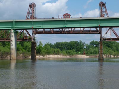
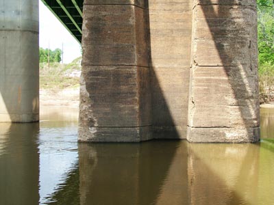
I have been talking to my friend Bill Burge who also has a Gemini. We both have had issues with the lift bridge that you see behind the highway bridge on the left. You see this lift bridge is controlled by a private plant and 3 years ago they left it at 49 feet. That can and is a problem at higher water. Bill did a bunch of research and called tons of people to find out that 2 years ago they are now leaving it at 55 feet at 1 percent flood. That means we shouldn't have a problem even though the water is higher than normal but not at flood. As you can see in the picture to the right we have 70 feet for the highway bridge and to the lower left we have much more than the indicated 45 feet. That is because the gauge to the lower left is when the bridge is down. So I'm pretty sure we have about the same 70 feet. In other words, it is a non-issue. However, the picture to the lower right indicates that if a tow otherwise known at a bunch of barges hits a bridge, it will take a chunk or two out of the concrete. I'll bet that was a shocking experience. |
 |
 |
 |
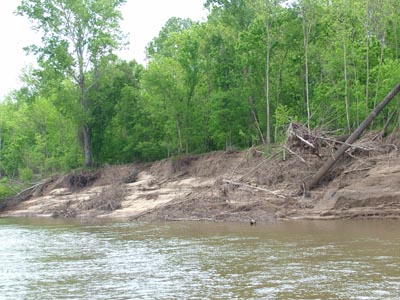 |
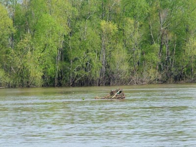
More trees for next year! Below left you can see some of the rock that is just below the Demopolis dam. We were trying to anchor and all that happened was our anchor would drag on the bottom. Well even a Rocna won't anchor on smooth rock. We pulled it up and went up a couple of miles and found a good place to drop our hook about 15 feet from shore. We were out of the way and all of the tow's missed us that night as they have every other night. Below right you can see what happens when the high waters leave their debris on a boat launch ramp. It looks like someone has some clean-up to do. |
 |
 |
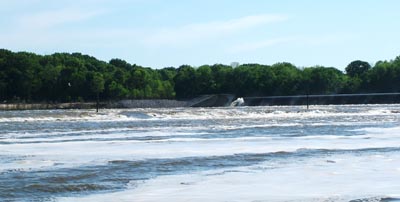
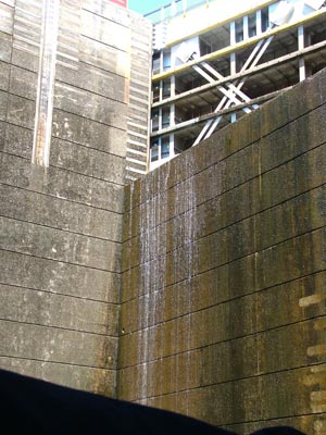
Demopolis Lock is a wonderful natural rock dam. It is something that you just want to experience. You can see a picture as we are about to enter the lock to the right. Of course I just had to get on top of our boat and take the picture you see on the bottom left of the water coming over the spillway. This is lots of water in case you didn't know it. At this time we have been making between 3.5 and 4.2 knots for the last bunch of days. After spending between 11 and 12 hours a day behind the wheel we are about ready for a half day off. However, that doesn't happen for a few more days. Below right you can see a picture of Demopolis Yacht Basin where we picked up fuel for the next trip to Columbus, MS. We will arrive there tomorrow, which is Thursday and we should be there at about noon. |
 |
 |
 |
 |
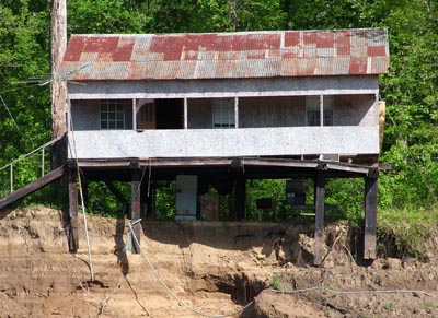
One of the most beautiful sights on the river are these white cliffs that you see through our windshield. You've seen these before in our previous trips on the waterway. Still, they are beautiful. Sometimes I just have to put in a picture of "I can't believe someone would do this!" Below left you can see that someone built a cabin on a bend of a river. The one thing you can count on is that the bend of a river will continue to expand. If you build a house on a bend, you better expect that it will come down. You can see that the forward stilts are no longer supported. I just wonder which trip we take on the river that we will have to avoid a house instead of a tree. Will it be the next one? Garry, this sunset is for you. Beautiful isn't it. Not the sunset you see on the ocean but still a great sunset on a river. |
 |
 |
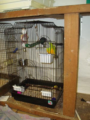
Jimmy Buffett just loves having breakfast with Deb. Deb just spoils this bird to death with tons of good stuff in his cage. He still loves to head for her breakfast and eat up, especially when it is cottage cheese. As you can see below we made it up to another lock and it was a no-brainer. However, the real story is coming up! |
 |
 |
 |
 |
We enter the Bevill Lock and as always we head for the forward most pin. The reason is that that is the calmest water in the lock on the way up. I have to confess I read a bunch about locking before we left. Since I never went through a lock in our boat, I did my research. I learned that you should always be prepared for a "sticking pin." After 60 or so locks a pin never stuck and I've never talked to someone that had one stick. If there was a bad pin, the lockmaster would say, "don't us pin 1 or 4 or whatever." You see the pins are supposed to float up with you. However, a pin can stick and just in case, I have a knife right next to the door to cut lines. Of course this was all hypothetical until today. We tied up to a pin by looping a line from our center cleat around the pin twice then brining it back to the cleat and wrapped it around the cleat 2 or 3 times but never tie it. Why? If the pin sticks you will never get the cleat knot off. So today Deb and I are both outside ready to fend off the lock wall and the water starts coming up. However, I noticed the pin didn't. BIG PROBLEM. The line was pulling down hard on our lifelines and I ran forward to remove the loops around our center cleat and try to get the line unlooped from the pin. FORTUNATELY, Deb did it right and I got it un-looped. Next I ran back to the helm station and took the wheel while calling the lockmaster about the stuck pin. |
He told me to try and stay forward in the lock because that was the smoothest water and he would slow down the water flow. Now I know why they don't want you floating around in a lock. The currents will take you in any direction and you have to run between fending off with a boat pole and back to the helm station when you've avoided hitting a wall. Are you thinking this sounds like fun? This continued and I was simply happy I own a boat with a movable outdrive. I was going from half throttle forward to half throttle backwards to running to the side and fending off and back to the helm again. Of course Deb was up front doing her thing fending off too. In the end, no damage just a good story. The lockmaster had no clue the pin was about to stick and of course neither did I. If I wouldn't have noticed it stuck, my first indication would have been when either the lifelines broke or the stanchions were ripped out of the boat. Of course next would have been the boat trying to turn on it's side while I would be hoping the line we tied to the pin would break. Well that is why I keep a very sharp knife next to the door and fortunately I didn't have to use it. Catching a stuck pin early is good and all that happened today was I got a good story. At least we were prepared! However, I think I will take my knife out of it's case next time we head for a lock and have it next to me on the seat just in case. Below you can see the stump puller and the wonderful museum that you saw when we came down in October. If you didn't see it, go back to our past logs and check out the inside of both of them. Tomorrow we will be going through another lock then docking in Columbus, MS. We should be posting and getting email with their wi-fi. After all of the 11-12 hour days, it is time for a half day off. |
 |
 |
 |
April 16 - On Friday we once again were moving big time and we actually did a 12 hour day and 5 locks. It wasn't bad just long. To accomplish a 12 hour day you are really working 13. At this point, I was pretty tired. After working 10 days straight at Green Turtle Bay with 10-12 hour days then driving back to Fairhope, provisioning the boat and off we went. We were ready for a break. We took a shorter day on Saturday and also on Sunday. The lock you see below is the 11th lock we passed through on the Tenn-Tom. This is the only one where the guy hops on a cart to check things out and come by to say Hi. It is a nice touch and much more personal than just on the radio. |
 |
 |
 |
 |
On Saturday we did the BIG lock at about 11 am and it is a BIG ONE. You've read about this in the past but suffice it to say we were lifted 83 feet and you really do get the feeling that you don't want the doors to break! In each case when they start filling a lock you have current that is generated because of the gravity fed water from the upstream side of the lock which of course is the highest side coming through the pipes and entering at the bottom of the lock. The easiest ride is at the very front of the lock on the way up and that is where we always head. |
 |
 |
| The amazingness of this lock is well amazing. By-the-way, is amazingness a word? I'm not sure you get the real perspective but when you look up 9 stories and realize that there is a wall of water back there, I still get a few chills thinking that I really do know where my tax dollars went. It is always a good thing to ensure that I am getting my money's worth from the tax dollars I paid when I was working. | 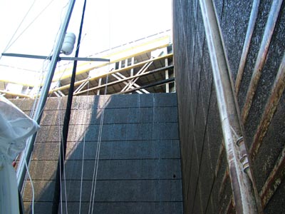 |
 |
 |
 |
The pictures you see here are where they cut through the continental divide. Again, I've explained all this in my past logs and I'm still not sure if I paid enough taxes to cover this bill. |
|
 |
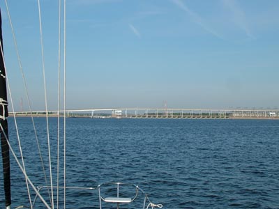
| This is the final bridge on the Tenn-Tom waterway. | 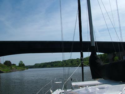 |
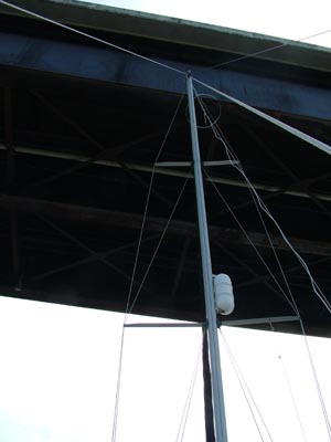 |
And we fit under it just fine. However we always look up. Right now we are at Grand Harbor Marina and want to send a special thank-you to to Chip Lucas who is the site manager. We always stop here because they are so nice, the restrooms are very nice, great laundry, well stocked ships store, reasonable priced fuel with Boat-US discount, and of course a fairly new courtesy van so you can reprovision and go out to lunch. They don't worry too much about time on the van as long as other people aren't coming and going as transients. Overall, they do a great job and if you are passing this way, you should try the marina out. I don't think you will be disappointed! Tomorrow morning we are taking off about 7 am and hoping our only lock going down will get us through promptly. So far, we have had no waiting on the locks so we are overdue for a setback. Last time we had to wait 3 hours and threw out the anchor. Hopefully we will get through and make good advantage of the current heading downstream to get a good start on our way back to Green Turtle Bay. We will update again when we get back to Kentucky Lake and then I have to figure out how many times we will update each week/month. I'm not sure about what I want to morph the site into at this point. I'm definitely not posting that I went to work at 8 and came home at 6 each day. Perhaps I will post about the different boats we are listing and what I'm learning about each one. A better idea is for you to let me know what you might want even it is just to be quite for awhile. Regardless, we will be back at it again this fall. Of course it just so happens that all of the wi-fi is down so for the time being, I can't update the site. Hopefully it will be back up before we leave in the morning. |
| April 30, 2009 - We made it. I'll have an update tonight. We arrived to our assigned slip just before 2 p.m. and it took two hours to mostly clean the outside of the boat. Then it was off to showers. We finished up just before 5. | |
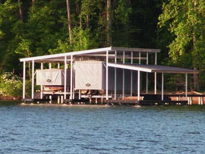
April 30, 2009 - 2nd update - We left Grand Harbor at Pickwick Lake and as we were rounding the corner heading for the lock I saw this really cool dock with the special covers that enclose the boats. I think this is one of the coolest things I've seen. I'm sure that all you have to do is pull a line or flip a switch and the cover comes up and you just drive the boat out. This would keep all of the pollen, dust, birds stuff and anything else you can think of out of the boat. I only wish I would have thought of this when I sewed my friend Tim at Lake of the Ozarks a rear cover for his boat. This would have been much simpler and also much easier and arguably as effective. I'll just bet that these covers are standard widths of material which makes it even easier to construct. |
 |
 |
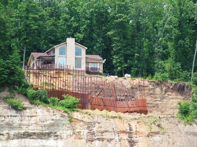
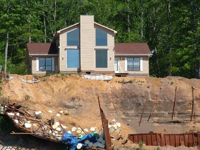
Ahead of us is Pickwick Lock. This is our first down lock and it drops us 55 feet. We were ecstatic because we didn't have to wait a minute to enter. This has been the greatest trip to the north! We haven't waited for a single lock which is the first time this has happened in our four trips. Now I knew this house was coming up for the entire trip on the waterway. I've seen the bank decaying and if you've read our site, you've seen it going away. So I just had to take a picture, on the left, from July of 2008 and compare it to a picture I took just 3 days ago. Don't you just hope they have insurance? Or should I say, if you are an insurance company, aren't you happy you didn't insure this house? I'm betting that in the next flood the chimney is gone along with the front of the house. Don't you just wonder what those white barrels are? This couldn't be a structural or soils engineers recommendation - or could it???? |
 |
 |
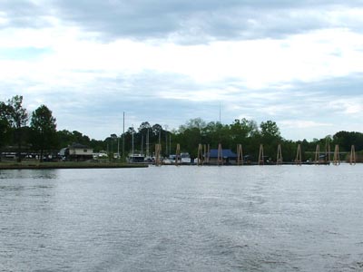
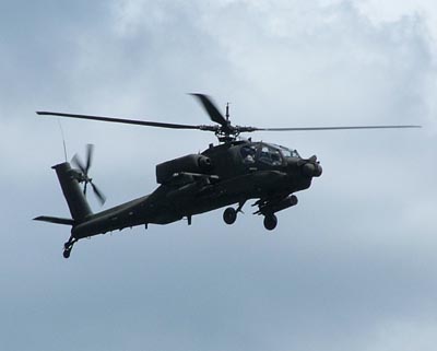
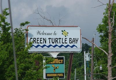
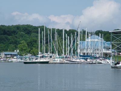
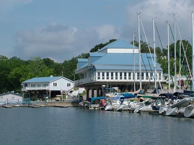
So here we are and once again the wonderful attack helicopter is running down the river and the pilot and co-pilot are checking us out. I actually am enjoying this part of the river. Perhaps it is because we started out with 2 knots of current assisting us. As the river widens out then the current dropped to 1 knot and finally to a half of knot. We set the spinnaker with about 10 miles left to go and sailed at the whopping speed of 1.8-2.5 knots in less than 5 knots of wind. It was great not hearing an engine. I am sick of hearing an engine. I can't wait for a middle of the week sail with 10-15 knots of wind with our asymmetrical spinnaker flying. Just too much fun! And then we arrived at Green Turtle Bay. By the way, if you ever buy fuel, buy fuel at places that have Valvtect additive. When we have a choice, we always buy fuel with this additive. It means we don't have to add our own stuff. Nice to once again see that our favorite marina uses the best fuel. Below you can see about a 1/10th of the marina. I think they have about 425 wet slips and a bunch of dry slips. We are in a wet slip and that is from both the top and bottom since it is raining right now. We couldn't be happier that we've arrived. |
 |
 |
 |
 |
 |
| Previous
Log - The most recent past log |
All
Logs - This takes you to the list of all of our logs |
Web Page by Jim Faughn